
Home › Maps › Belgium › West Flanders
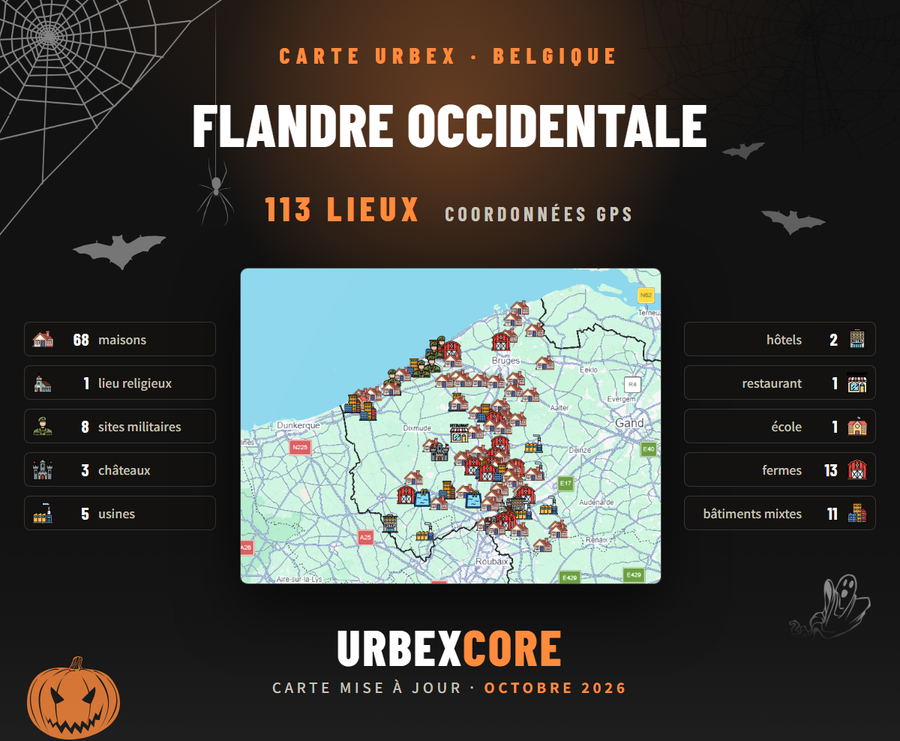
West Flanders113 places
Urbex map West Flanders.
★★★★★4.9/5 · 458 explorers equipped
113 verified abandoned places, with their GPS coordinates, sorted by type of place. The map opens in your Google Maps or Google Earth.
€14,99Taxes included.
🎁 −10% extra with the code URBEX10, to use at checkout.
One payment · lifetime access · sent in under 30 min
- 100% secure payment
By buying, you accept our Terms · Privacy · Refunds
- Sent in under 30 minutesby hand, in the vast majority of cases
- Opens in Google Maps or Google Earthnothing to install, the map appears on your phone
- Verified placesprecise GPS coordinates, sorted by type: factories, castles, hospitals, bunkers…
- Regular updatesyou keep access to new places without paying again
- We answerby e-mail or on Instagram, before and after your order
What the map contains113 places · 10 categories
113 abandoned places in West Flanders, sorted by type.
The West Flanders urbex map gathers 113 verified abandoned places in West Flanders, Belgium: houses, factories, castles, military sites, religious places and more. Each place has its icon by type and its exact GPS coordinates; the map opens in your Google Maps or Google Earth, on your phone as well as on your computer.
 68houses
 1religious place
 8military sites
 3castles
 5factories
 2hotels
 1restaurant
 1school
 13farms
 11mixed buildings
Exploring elsewhere? See all the maps of Belgium or the Ultimate Map, 14 countries.
SimpleEnd to end
Three steps, and you're exploring.
- 1You orderSecure payment, in one minute.
- 2We open your accessSomeone checks your order and opens the map for you by hand, in under 30 minutes in the vast majority of cases.
- 3You goOn your phone, in the field. Tap a place, follow the route. Nothing else to learn.
FAQBefore you buy
The questions we get asked.
What exactly is a UrbexCore map?
A private Google My Maps map, opened on your Google account. Each place has an icon by type (factory, castle, hospital…), its GPS coordinates and directions in one tap.
How do I receive my map?
We send it by hand, in under 30 minutes in the vast majority of cases. Access is opened on your Gmail address — you need one — and the map opens directly in Google Maps or Google Earth.
Why do I need a Gmail address?
Access is personal: the map is opened for you, on your Google account. That is what keeps the spots from circulating freely. If you don't have a Gmail address, you need one — it's free and takes two minutes.
Is it a subscription?
No. You pay once, the map is yours for life, updates included. No hidden fees, no renewal.
Are the places really abandoned?
They were verified when added. But places change: some places get renovated, bricked up or guarded over time. We update the maps regularly, and you keep access to the updates without paying again.
Can I get a refund?
Non. C’est un contenu numérique, ouvert à ton nom sur ton compte Google : une fois l’accès envoyé, il n'y a ni retour ni remboursement. Si tu as un souci avec ta carte, écris-nous, on t'aide.
Is it legal to explore these places?
Coordinates are provided for information only. Urban exploration can be illegal or dangerous depending on local laws and the state of the buildings. You remain solely responsible: respect the law, private property, and your own safety.
UltimateThe most complete
